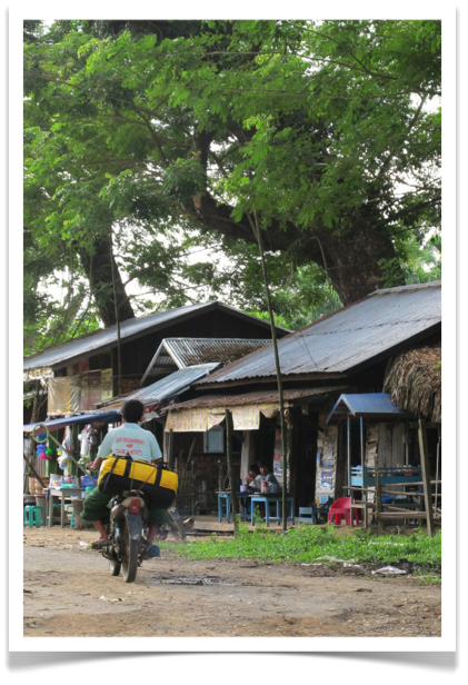
Follow petcha on Twitter
Search
Journals
Amazon Associate

If you see books or music or tools on this site that you would like to buy through Amazon, click here and thus i have seen will get a small percentage of the purchase price of the item. Thank you. 

The Elements of Typographic Style

Patagonia Synchilla Snap-T Pullover

Minding the Earth, Mending the Word: Zen and the Art of Planetary Crisis

North Face Base Camp Duffel (Medium)


Entries in Sagaing Division (11)

Tuesday
Mar182014

Police Escort

The guys in the back are being shown how to dowload a waypoint on the GPS receivers that we are loaning them. The guys in the front, the ones with the machine guns, are policemen from Leshi who walked over to Tikon (see Faces of Tikon) to make sure that we were safe while we did our inventory transects. [NOTE: Both of the policemen were extremely nice and very helpful. Still unclear as to whether they actually had bullets in their guns]. 

Friday
Nov222013

From the Boat II

Purple boats and pagodas. And sawlogs. The Upper Chindwin river of northern Myanmar. [NOTE: Our boat was (kind of) yellow].

Tuesday
Nov192013

More Myanmar Growth Bands

This video by Kyaw Thin Latt from the WCS Myanmar Program was taken in the forest outside of Tikon the day we made dendrometer bands. It provides a good overview of the bands (in Burmese), documents the group of foresters, villagers, WCS staff, and policemen (with semi-automatic weapons) that went to the field that day, and shows Rob Tizard and I sharing a joke - when we probably should have been paying attention to the tree-banding. Nice job, Latt. [NOTE: I was never able to determine if the policemen actually had any bullets in their guns]. 

Thursday
Nov142013

Musket


This Naga man from Tikon accompanied us to the forest the day we put growth bands on some of the timber trees (more on this later). And he brought along his handmade musket. Didn't really come across anything for him to hunt, but he was certainly ready. And he did learn how to make a dendrometer band. [NOTE: I struggled a bit to get this posted, because I'm using some new equipment now (see Colophon)

Thursday
Nov072013

Thambuddhei Paya

The 25 hour boat ride ends up in Monywa, a major trade center in Sagaing Division. Monywa is also home to the exquisite Mohnyin Thambuddhei Paya (shown above), which is one of the most beautiful examples of religious architecture I've ever seen. The temple dates from 1303, and is said to contain over 500,000 statues of Buddha. The walls are lined with them. All, to my eye, seem subtly different.

A close-up of one of the walls showing the detailed work is offered below. I couldn't stop taking pictures in here. [NOTE: I made a small donation to have a Buddha placed along the wall in my name. No idea where they are going to squeeze in one more statue].  

Wednesday
Nov062013

Rice Field

Rice field outside of Homalin in Sagaing Division, Myanmar in late afternoon sun. Whatever effort is required to get to northern Mynamar disappears the moment you catch a glimpse of a landscape like this.  The Chindwin River is off to the left of the image. 

Friday
Nov012013

Duffel Bag

I travel with a canary yellow (summit gold) North Face Base Camp duffel bag. Size medium works best for me. Waterproof, virtually indestructable, super-stuffable, makes a good back rest or pillow for 25 hour boat rides, and the yellow color is easy to spot when all the bags are unloaded and thrown into a pile.

Image above shows my duffel being carried to the Upper Chindwin River in Sagaing Division to be put on the boat for the aforementioned 25 hour boat ride from Htamanthi to Monywa. I spent a lot of time sleeping on it. [NOTE: I've had this duffel for about 5 years. It's a terrific bag].

Thursday
Oct312013

Faces of Tikon


This is what the village of Tikon looks like the first time you arrive and the rain has just stopped and the sun comes out and you are very happy to have finally made it. You are up at over 4000 feet and things have started to get a little chilly.

And this is what the village looks like in the late afternoon when you've walked out to find the path to tomorrow's transect and you turn back to check out the landscape. Magical. [NOTE: It was clear and sunny every day that we worked in the field and only started raining the last day when we walked out to Mile 25 camp. Magical].

Wednesday
Oct302013

Tikon


N 25.50226°
E 95.02700° 

Back in Yangon with internet. Image above shows the start of Transect 1 (note red transect rope) in the forest outside of Tikon in the Naga Hills Autonomous Region of Sagaing Division. Some of the most beautiful tropical montane forest I've ever seen. Tikon is a lovely Chin/Naga village of 13 households that has been in the same place for 96 years. You walk for ten miles to get there. More on this incredible place later.

Tuesday
Oct012013

Naga Hills


26º10.257'N
95º19.372'E
1067 m (more or less) 

Hope I'm not getting ahead of myself here as my visa won't be ready until Thursday. Fingers crossed. Google Earth image (above) shows the region in Sagaing Division, Myanmar where I will be heading in two weeks. Flying into Hkamti airport along the Upper Chindwin and then hiking for several days to get into the Naga Self-Administered Zone to start a community forestry project. Naga people represent 17 tribes inhabiting northeastern India (yellow line in satellite image is Indian border) and northwestern (Kachin State, Sagaing Division), Myanmar.